![Appalachian Trail, Bailey Gap to Calf Mountain [virginia]](/store/9781597756419.jpg)
National Geographic Maps
- Waterproof - Tear-Resistant - Topographic Map
The Bailey Gap to Calf Mountain Topographic Map Guide makes a perfect traveling companion when traversing the central Virginia section of the Appalachian Trail (A.T.). The A.T. in central Virginia falls mostly within National Forest land, traveling through mature forests and over high mountain summits. The trail becomes more difficult as hikers go farther south, traversing the A.T.'s northernmost balds, past interesting rock formations, and over notable peaks, such as the Priest, McAfee Knob, and Dragon's Tooth.
Each A.T. Topographic Map Guide includes detailed topographic maps at a detail of 1 inch = 1 mile. Each page is centered on the A.T. and overlaps with the adjacent pages so there is little chance of getting lost. Along the bottom of each page is a trail profile that shows the distance between shelters, camping areas, and trail access points. The map and trail profile provide a step by step visual guide to hiking the trail, mile by rugged mile. The Topographic Map Guide is built for all levels of hiking enthusiasts, from the day tripper to the multi month 'thru-hiker'. The front pages of the printed Topographic Map Guide include resupply information, town inset maps, camping options, and much more.
Every Topographic Map Guide is printed on Backcountry Tough waterproof, tear-resistant paper. A full UTM grid is printed on the map to aid with GPS navigation.
Other features found on this map include: Afee Knob, Apple Orchard Mountain, Appomattox, Bailey Gap Shelter, Black Horse Gap, Bobblets Gap Shelter, Brown Mtn Creek Shelter, Bryant Ridge Shelter, Calf Mountain, Calf Mtn Shelter, Campbell Shelter, Catawba Mtn Shelter, Cornelius Creek Shelter, Cove Mountain Shelter, Cow Camp Gap Shelter, Fullhardt Knob Shelter, George Washington National Forest, Harpers Creek Shelter, Humpback Mountain, Jefferson National Forest, Johns Hollow Shelter, Johns Spring Shelter, Lamberts Meadow Shelter, Laurel Creek Shelter, Lynchburg, Matts Creek Shelter, Maupin Field Shelter, Niday Shelter, Paul C. Wolfe Shelter, Pickle Branch Shelter, Pine Swamp Branch Shelter, Punchbowl Shelter, Reeds Gap, Rockfish Gap, Sarver Hollow Shelter, Seeley- Woodworth Shelter, The Priest, The Priest Shelter, Thunder Hill Shelter, Troutville, War Spur Shelter, Waynesboro, Wilson Creek Shelter.
- Map Scale = 1:63,360
- Folded Size = 4.25 x 9.25
member goods
notems store
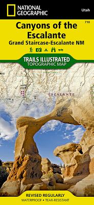
Canyons of the Escalante [grand ...
by National Geographic Maps - Trails Illust
Calendar/Blank Book /Folded$11.21

listens & views